|

|

|
|
|

|
|
The Climate and the Land
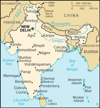
India is known as a "subcontinent", with an area of about 3.3 million square kilometers. Northern
India is separated from the rest of Asia by the Himalayan Mountains. The country is surrounded by the
Bay of Bengal in the east, the Arabian Sea to the west, and the Indian Ocean to the south.
This immense land mass has many climatic and physical variations. The temperature, and
environment change drastically as one travels through the country. Likewise, the land itself
changes; there are mountains and deserts, vast plains and tropical jungles. Yet, it is all one
nation.
| India is divided into three large geographic regions:
|
| There are also three main river systems: the Ganges, the Indus, and the Brahmaputra. All begin in the Himalayas. |

Northern India: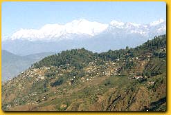
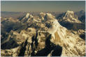
The Himalayas are the largest mountain range in the world, extending 2,500 kilometers and dominating
Northern India. The range is bounded by the Indus and the Bhramaputra Rivers. The Western
Himalayas include the Kashmir region, while the central peaks extend over Uttar Pradesh state. Eastern
Himalayan mountains reach into North Bengal, Sikkim, and Arunachal Pradesh.
|
Rajasthan: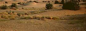
Just below the Himalayas is Rajasthan, known for its Thar Desert. The Thar actually extends into
parts of the states of Gujarat, Haryana, and Punjab as well as Rajasthan. It derives its name
from the word "thul", meaning sand ridges. The desert recieves less than 10 inches of rain per year and supports only
sparce vegetation. Yet, it yields salt and gypsum.
|
Western India: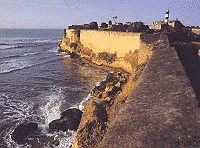
Western States include Gujarat, Maharashtra, and even Goa in the Southwest. These coastal areas
are generally more temperate than Northern areas and engage in much commerce and trade. The
west is separated from the Thar Desert by the Aravalli Mountains. In this section of India, there
are plains and highlands that produce millet, wheat, and pulses. There is also a thriving fishing
industry. The Western Ghats are a steep mountain barrier along the western coast. The Ghats separate this
green area from the drier inland plateau region.
|
The East: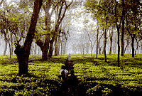
The Northeast has rich biological resources, as it is mainly tropical land with evergreen and
semi-evergreen rain forests. There are also swamps and grasslands. The coastal region in the
East is largely made up of mangroves and submerged coral reefs.
|

To top of page
The creator of this site would like to thank:The Government of India tourist office in Europe (http://india-tourism.com/eindex.cfm)
Interknowledge India
The Library of Congress country study: India (http://lcweb2.loc.gov/frd/cs/intoc.html)